Transform Point Clouds into BIM (Building Information Model)
Scan to BIM Services
Scan to BIM Service TORONTO – Accurate As-Built Modeling for Every Industry
At IFI 3D Technologies, we provide Scan to BIM services across Canada, helping architects, engineers, contractors, and facility managers bridge the gap between real-world conditions and design intent.
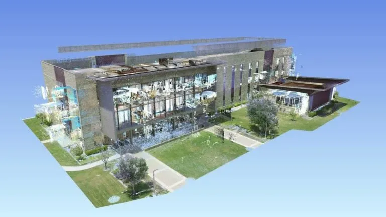
Using 3D laser scanning (LiDAR) technology, we capture high-precision as-built point cloud and convert into BIM-ready Revit models, 2D floor plans, and CAD drawings. With millimeter-level precision powered by MATTERPORT, our team ensures your project data is reliable, unified, and construction ready.
Whether it’s commercial complex, oil & gas plants, government facilities, healthcare campuses, educational institutions, or heritage buildings, our nationwide service delivers the accuracy, speed, and quality you need.
Our services
Explore Our Scan to BIM Modeling Services
Our Scan to BIM Process
Site Capture
High-resolution 3D laser scanning records millions of points in hours.
Point Cloud Registration
Data cleaned, aligned, and merged into a single dataset.
BIM Model Creation
Architectural, Structural, and MEP elements modeled per LOD specs.
Quality Assurance
Accuracy verified through both AI-driven checks and manual review.
Deliverables
Model delivered in RVT, IFC, DWG, OBJ, STL, or CAD formats, fully ready for design, construction, or facility management.

Applications of Scan to BIM
- Architecture, Engineering, and Construction (AEC): Renovation, retrofits, adaptive reuse, and validation of as-built conditions.
- Facility Management: Digital twins for asset management, space planning, and energy efficiency.
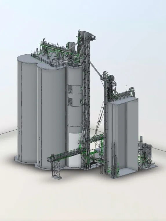
- Industrial & Manufacturing: Plant layout, piping documentation, and maintenance planning.
- Oil and Gas: Laser scans of refineries, offshore rigs, and tank farms for safety and compliance.
- Heritage Preservation : Detailed capture of historical landmarks for conservation and restoration.
- Government Infrastructure: Bridges, tunnels, and utilities scanned for rehabilitation and analysis.
- Real Estate Development: Accurate models for investment feasibility and planning.
Accuracy
Level of Detail According to your needs
The specification of the BIM models can be tailored to your project’s specific Level of Development (LOD) requirements (e.g., LOD 100, LOD 200, LOD 300, LOD 350, LOD 400, LOD 500). Commonly included model elements:
- Architectural Elements: Walls, doors, windows, floors, ceilings, roofs, staircases, and facade details.
- Structural Components: Beams, columns, slabs, foundations, trusses, load-bearing walls, and framing.
- MEP (Mechanical, Electrical, Plumbing) Systems: HVAC ducts, electrical conduits, piping, fire suppression systems, and equipment placement.
- Site & Civil BIM Models: Topography, underground utilities, site features derived from LiDAR scanning.
- As-Built Models: Detailed, information-rich models representing existing conditions.
- Fixtures and Equipment: Built-in furniture, millwork, mechanical units, lighting fixtures, and access control elements.
- Clash Detection & Coordination: Identifying conflicts between MEP, structural, and architectural components.
- Quantity Take-Offs: Accurate material and component counts directly from the model.
Scan to BIM | Benefits and How It Works
Our Scan to BIM Process: From Planning to Model Delivery
From initial kickoff to final delivery, our streamlined Scan-to-BIM pipeline converts complex physical infrastructure into intelligent digital assets.
Phase 1: Discovery & Scoping: We analyze your existing site documentation and tailor the project scope around your exact design and engineering requirements.
Phase 2: Scheduling & Alignment: We establish project milestones and conduct a kickoff session with key stakeholders to ensure total operational clarity.
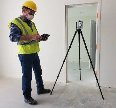
Phase 3: Precision LiDAR Capture: Our field technicians perform on-site 3D laser scanning to record accurate spatial telemetry across every square foot.
Phase 4: Data Refining & Registration: We process, filter, and register raw point clouds into a pristine, unified dataset ready for authoring.
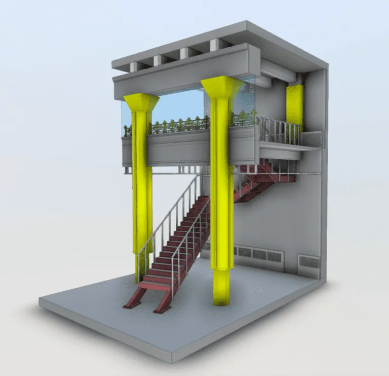
Phase 5: Parametric BIM Authoring: We translate refined spatial data into rich, parametric BIM formats like Revit, IFC, or DWG based on your workflow.
Phase 6: Validation & Handover: We perform meticulous audits to guarantee your model meets exact spatial tolerances and specified LOD standards.
Rely on IFI 3D Technologies to deliver the clarity, precision, and reliable performance needed to elevate your project outcomes.
Why Choose IFI 3D Technologies for Your Scan to BIM Projects?
Why Choose IFI 3D Technologies for Scan to BIM?
Engineering-Grade Accuracy – ±2–4 mm precision with calibrated scanners.
BIM-Ready Deliverables – Revit, IFC, Navisworks, CAD, and mesh model.
Flexible LOD Models– From LOD 100 (conceptual) to LOD 500 (as-built).
Strict QA/QC – Automated and manual checks on every project.
Proven Expertise – Years of experience, with case studies across industries.
Autodesk Revit
BIM Output Formats and LOD Levels
📂 Supported File Formats
We provide as-built deliverables tailored to your project’s needs:
| Deliverable | File Format | Use Case |
| Point Cloud Data | E57, LAS, PTS, RCP | Raw scan data for further processing & modeling |
| 3D BIM Models | RVT (Revit), IFC, DWG | BIM integration, design, construction planning |
| 3D Mesh Models | OBJ, STL, FBX | Visualization, rendering, and prototyping |
| CAD Files | STEP, IGES, DXF | ideal for reverse engineering, manufacturing |
📌 Customization & Additional Services
- LOD-based model refinement for architecture, MEP, and structural analysis.
- 360-degree panoramic images and orthographic views to complement the BIM model.
- Clash detection reports and compliance validation to ensure seamless project execution.
FAQ: About Scan to Bim
To help you better understand our Scan to BIM solutions, we’ve compiled answers to the most commonly asked questions.
Industries such as architecture, construction, facility management, manufacturing, and historic preservation use Scan to BIM for accurate as-built data, digital twins, and efficient project execution.
Revit scan to BIM services costs vary depending on the complexity and size of the project. For more details about our services, you can contact us directly.
To create an accurate BIM model from point cloud data, the following inputs are essential:
- Raw Point Cloud Data – Accepted formats are.PTS, .PCG, .XYZ, .FLS.
- Revit-Compatible Recap Files – Formats are.RCS, .RCP.
- Scan Point or Station Plan – Ensures proper scanner alignment for accuracy.
- Bubble View / Panoramic View – Provides visual context for modeling details.
The key difference is the output format; Scan to BIM provides output in Autodesk Revit (.rvt) format while Scan to CAD delivers files in CAD (.dwg) format. In BIM implementation, you receive a 3D model with IFC format for interoperability whereas CAD outputs include plans, sections and elevations.
At IFI 3D, we use industry-leading software to convert raw point cloud data into intelligent BIM models ensuring precision and smooth integration into your project.
- Autodesk Revit – For advanced BIM modeling and architectural visualization.
- Autodesk Recap Pro & Recap 360 – For processing and managing point cloud data.
- Autodesk DWG TrueView – For seamless CAD format compatibility.
A successful scan should capture all critical site details including:
- Topographical Data – Elevation, contours and slopes for accurate site analysis.
- Existing Structures & Infrastructure – Buildings, roads, utilities and industrial equipment.
- Key Site Features – Boundaries, landmarks, vegetation and natural elements.
- Architectural Elements – Windows, doors, facades and structural details.
- Potential Obstacles & Underground Features – Hidden elements that may affect construction.
IFI 3D specializes in comprehensive 3D scanning solutions ensuring no detail is missed whether for renovations, new construction or documentation.
Scan to BIM helps developers analyze site conditions with precise 3D models providing insights into terrain, drainage, infrastructure and environmental factors. It assesses elevation changes, erosion risks, solar exposure, and stormwater management ensuring efficient land use planning. By integrating accurate site data early on, developers can optimize designs, reduce environmental impact and improve project efficiency.
Elevate Your Project’s Success
At IFI 3D Technologies, we provide highly accurate digital representations of buildings for architects, builders, engineers, and developers. Our Scan to BIM ensure precision, clarity, and efficiency, delivering point clouds, 2D CAD drawings, and Revit models for seamless project execution.
📍 Get the data you need to build with confidence!
- 3D Laser Scanning Services 24*7
- IFI3DIMMERSIVE[at]gmail[dot]com
- +1 647 247 7601